
An hour south of Lahinch, where the Shannon Estuary meets the Atlantic and County Clare finally runs out of road, there's a lighthouse that's been pointing west since 1854 and a stretch of coast that gets a fraction of the visitors it deserves. The Cliffs of Moher are up the road and everyone knows about them, which is exactly why Loop Head on a quiet October morning is a different thing entirely. Kilkee, Carrigaholt, the Bridges of Ross, and then nothing except the end of the land and all of the ocean. Take the day.
The drive south from Lahinch
From Lahinch you head south on the N67 through Milltown Malbay and Spanish Point, and the road follows the coast closely enough that you'll stop the car at least twice before Kilkee. That's fine. The whole point of this day is to be somewhere nothing is competing for your attention. Kilkee is about forty-five minutes from Lahinch. From Kilkee the peninsula narrows and empties out, and by the time you're twenty kilometres past town on the L2000 you might meet two other cars in the same stretch. There are some very relaxed cows. The signage to the lighthouse is decent and you won't get lost, which is lucky because the phone signal is patchy once you're past Carrigaholt.
Kilkee: sort yourself out here first
Kilkee is a proper west Clare seaside resort in a way Lahinch isn't quite, and the distinction matters. This is not a village that tolerated tourism because it had to. Generations of Clare families have been coming here in July for a hundred and fifty years, and the town carries that history with a relaxed self-assurance that's hard not to warm to. A sheltered crescent bay, a sea wall, an ice cream place on the front that has been there since roughly forever. Richard Harris spent summers in Kilkee as a child and there's a statue of him on the main street, looking out at the bay with the expression of a man who knows the story about him is being slightly embellished but can't be bothered correcting it.
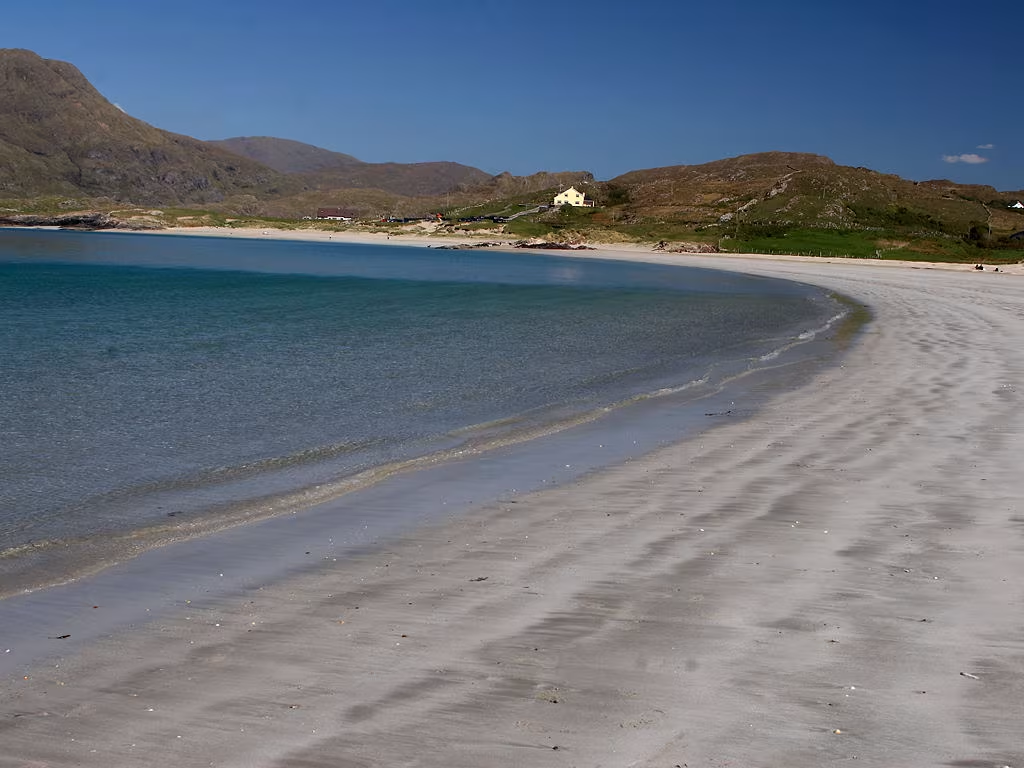
The reason to be in Kilkee early is the Pollock Holes. These are natural rock pools at Diamond Rocks on the southern end of the bay: two proper swimming pools carved by the sea into the limestone over an impressive amount of geological time, fed by the Atlantic on every tide. They're deep enough to swim well in and on a June morning they hold enough warmth to make the swim pleasant rather than an act of self-punishment. (In January they're cold in the clarifying, deeply Irish way that cold things are always described as bracing by the person who talked you into going in.) Busy mid-morning in summer. Get there before ten or after four and you'll have more room. The walk from town along the cliff path takes about fifteen minutes and is worth the walk either way.
Carrigaholt and the Shannon side
Coming south from Kilkee through Moyasta to Carrigaholt, you've switched coasts. You're on the Shannon Estuary now rather than the open Atlantic, and everything changes: calmer water, gentler air, Kerry visible across the estuary on a clear day. The village is small and sits on the water with a fifteenth-century tower house castle at the pier end. It's a five-minute stop and the setting is exactly what a fifteenth-century tower house on a tidal estuary should look like, which is to say quite something when the light is right and the tide is in.
The Long Dock in Carrigaholt is the place to eat on this trip: seafood done properly and without ceremony, a lunch that makes you understand why people drive all the way down here specifically for it. It gets busy in summer. Bottle-nosed dolphins work the estuary and are sometimes spotted from the pier, which the local boat trips will confirm with great enthusiasm and timelines that are, in our experience, a bit optimistic about when exactly the dolphins will decide to show up.
The Bridges of Ross
Back on the Atlantic coast, heading toward the lighthouse, the road passes Ross Strand and the short walk out to the Bridges of Ross. These are natural limestone sea arches formed by the Atlantic over a very long time: stacks and a surviving arch above dark churning water, with the full ocean hammering in on the far side. There used to be two arches. One went in a storm in 2014, which is useful context for the question of who, ultimately, is in charge of west Clare limestone. The one that remains is class. The cliffs in both directions from it are worth walking further than you planned, and you'll probably end up spending forty minutes here when you thought it would be fifteen.
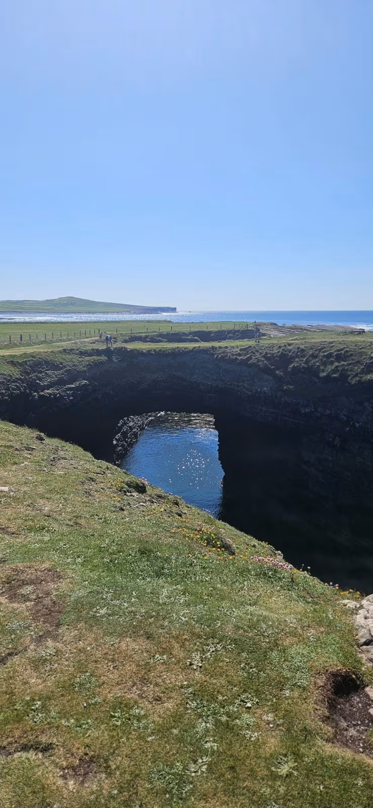
In September and October the Bridges of Ross becomes one of the better seabird watching spots on the Irish coastline. Rare migrants from North America and the Arctic arrive on the back of Atlantic weather systems, and if you turn up to find a row of people with enormous telescope rigs all pointing at the same patch of ocean, give them their space. Don't ask what they're looking at unless you are genuinely prepared for a detailed answer, because they will give you one.
Loop Head Lighthouse
The lighthouse has stood at the tip of the peninsula since 1854 where the Shannon Estuary and the open Atlantic finally sort themselves out from each other. The current tower is Victorian, well-maintained, and the setting tells you clearly why it's there: this is the point where ships heading for Limerick from the Atlantic have to commit to the estuary, and someone needs to tell them where the rocks are in the dark. Commissioners of Irish Lights run guided tours through the tower, the former keeper's cottages, and the fog signal building in summer. Take the tour. The guide here knows the history cold and tells it without any of the forced cheerfulness that heritage sites sometimes suffer from.
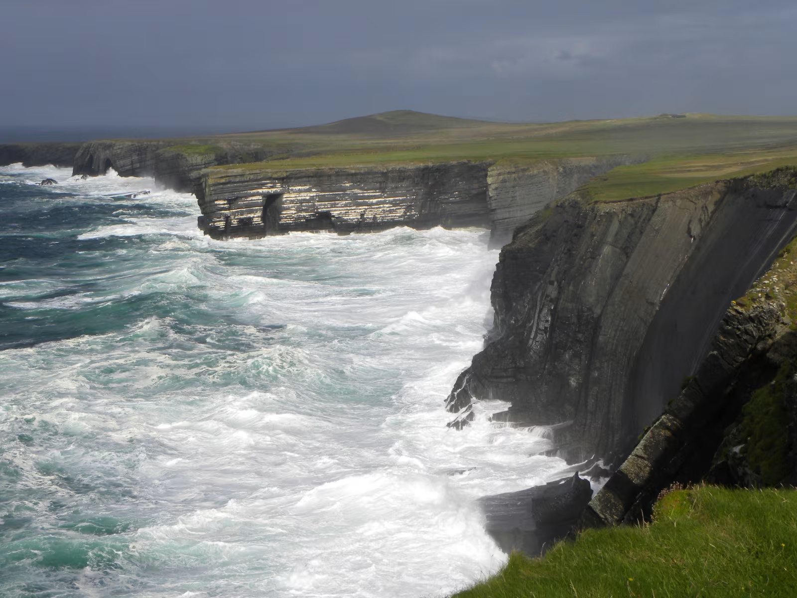
The view from the point on a clear day is the thing you came for. Kerry to the south across the mouth of the Shannon, with Brandon Mountain sitting there on the Dingle Peninsula. The Aran Islands to the north in the mouth of Galway Bay. On a very clear day the Connemara mountains are visible further north still. The whole Atlantic facade of the country laid out at once, which gives you a physical sense of Irish geography that a map doesn't quite manage. The wind at this point ranges from noticeable to decisive depending on the month. Bring a layer.
The cliff walk around the point is worth doing even outside of lighthouse tour hours. The geology here is layered, coloured, and dramatically folded in the way that west Clare limestone geology tends to be, and on a good day with the ocean heaving below and nobody selling anything within thirty kilometres, it's the kind of place that makes you feel better about things in general, which is the best possible thing a cliff walk can do.
The practical side of the day
The drive from Lahinch to Loop Head and back is roughly 130 kilometres in total, and you're not covering it quickly because the whole point is to stop. Allow the full day. The sensible order is: Kilkee and the Pollock Holes in the morning, Carrigaholt for lunch, the Bridges of Ross on the way out to the lighthouse, finish at the lighthouse in the afternoon when the westerly light on the cliffs is at its best. You can reverse it but you'd be driving into the sun for the afternoon stretch.
There's no petrol beyond Kilkee. Fill up before you leave. There's a small shop in Kilbaha, the last village before the lighthouse, but don't depend on it for serious provisions. The lighthouse visitor centre has a small café in summer that handles the basics.
If you're working out how Loop Head sits alongside the other Clare day trips, the guide to a day at the Cliffs of Moher from Lahinch covers the other major coastal option, and the Burren guide from Lahinch is the third one worth knowing about. For the question of where to base yourself in Clare in the first place, the Doolin versus Lahinch comparison goes through the tradeoffs properly. Loop Head is meaningfully easier to reach from Lahinch than from Doolin (roughly twenty minutes less each way), which is one concrete point in Lahinch's favour if this drive is on your list.
How long does the Loop Head day trip take from Lahinch?
Allow a full day. The drive from Lahinch to Loop Head lighthouse is about an hour each way. Add time in Kilkee, a lunch stop in Carrigaholt, the Bridges of Ross walk, and the lighthouse tour and you're looking at six to seven hours in total. A shorter version skipping Kilkee and Carrigaholt takes three to four hours, but you'd be cutting out most of what makes the peninsula worth the day rather than just the lighthouse.
Is Loop Head Lighthouse open to visitors?
Guided tours run in summer, generally from late May through September, operated by Commissioners of Irish Lights. The tour includes the lighthouse tower, the former keeper's cottages, and the fog signal building. There's a visitor centre with a small café on site. Check current opening times and whether booking is required before you travel, as hours vary by season and it can fill up on summer weekends. The surrounding grounds and cliff walk are accessible year-round even when the lighthouse tour isn't running.
What are the Pollock Holes at Kilkee?
The Pollock Holes are natural seawater rock pools at Diamond Rocks on the southern end of Kilkee Bay. The sea has carved them into the limestone over a very long time and they're deep enough to swim in properly. They're fed by the Atlantic on every tide, which keeps the water clear and reasonably fresh. Popular with locals and visitors in summer. The walk from Kilkee town centre along the cliff path takes about fifteen minutes. In summer they get busy between ten and four; earlier or later is quieter.
What is the Bridges of Ross and how do I get there?
The Bridges of Ross is a natural limestone sea arch on the north coast of Loop Head Peninsula, about fifteen kilometres from the lighthouse and about five kilometres west of Kilkee on the coastal road. The name refers to what were originally two arches; one collapsed in a storm in 2014. Reach it by parking at Ross Strand (there's a small car park) and walking along the cliff path for about ten minutes. The site is also a notable seabird observation point in autumn, when rare migrants arrive from across the Atlantic on bad weather systems.
Are there restaurants near Loop Head?
The Long Dock in Carrigaholt, about eighteen kilometres from the lighthouse, is the main option for a proper meal and does good seafood. In Kilkee, thirty kilometres from the lighthouse, there are several restaurants and cafés on the main street. The Loop Head lighthouse visitor centre has a small café in summer. There is nothing in terms of food or drink beyond Kilbaha, the last village before the lighthouse, so sort yourself out before you go that far.