
Twenty-five minutes south on the DART from Pearse Street and you're in a place that doesn't look like the city at all. Dalkey drops you into a village with a medieval castle at the end of the main street, a harbour a twelve-minute walk away where boats run to an island with wild goats and grey seals, and a hill above the whole lot with what Dubliners will tell you, with complete sincerity, is the best view in Ireland. The fare is a few euro on a Leap Card. Honestly it's a bit embarrassing how good the deal is.
Getting there
The DART is the only sensible way to do this. Dalkey is about 13km south of the city centre on the same line that runs through Sandymount, Blackrock, and Dún Laoghaire. Board at Connolly, Tara Street, or Pearse and ride to Dalkey station, which takes about 25 minutes from Pearse. The DART runs every ten to fifteen minutes on weekdays, a bit less frequently on Sundays, and the fare from city centre with a Leap Card is around €2 to €3. The full guide to Dublin day trips without a car has Dalkey alongside the rest of the DART's best stops, in case you want to combine it with something else on the same ticket.
The village
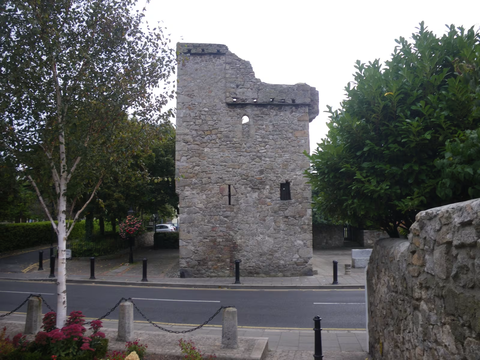
Dalkey was a serious town long before Dublin caught up. In the thirteenth and fourteenth centuries it was the main landing point for ships entering Dublin Bay, the Liffey mouth being trickier to navigate with a loaded vessel, and the locals did well out of it. Seven castles were built in the village over the medieval period, of which several still stand. The most intact is Dalkey Castle on Castle Street, now the Dalkey Castle and Heritage Centre, which runs living history tours with costumed guides demonstrating medieval cooking and the occasional theatrical swordsmanship. It's better than it sounds, especially if you have children who need entertaining before the hill.
Castle Street is worth a slow walk. The main drag is about 200 metres, lined with cafes, pubs, and the kind of independent shops that used to be everywhere before every high street started looking like every other high street. Dalkey has become one of the more expensive corners of Dublin over the years. The village has a habit of reminding you it was interesting before it got fashionable.
Coliemore Harbour and the island
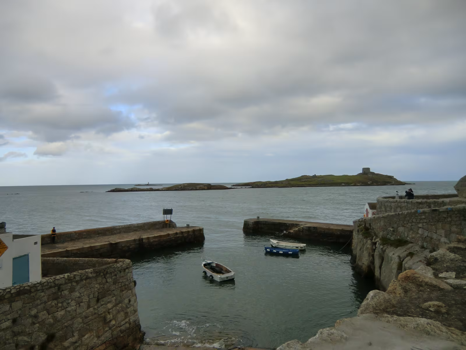
From the village, follow Castle Street south for about twelve minutes on foot and you reach Coliemore Harbour, a small working harbour that looks directly across at Dalkey Island, which sits about 300 metres offshore. It looks close enough to swim to. Some people do swim to it. Most people take the boat.
Seasonal ferries run from the harbour in summer, roughly May to September depending on the operator, so check locally before you go because it's a small operation and weather plays a part. The crossing takes five to ten minutes. The island is uninhabited and has been for a long time, and whatever it has is more or less left alone: the ruins of St Begnet's Church, which dates to the seventh century, a Martello tower built during the Napoleonic wars to watch the bay, and a colony of wild goats that arrived at some point nobody can pin down and has been there ever since. Grey seals are on the rocks most days. The goats are unimpressed by visitors in a way that suggests they've worked out the power dynamics of this particular situation.
Killiney Hill
South of Dalkey, either a twenty-minute walk along Vico Road or one stop further on the DART to Killiney station and then ten minutes on foot, is Killiney Hill Park. Free, open year-round, and the path to the summit is well-marked and takes about twenty to thirty minutes at a comfortable pace. The upper section is steep and involves some rough stone steps, and you'll feel it in your legs on the last stretch, but then you get to the top and the view does what a good view should do.
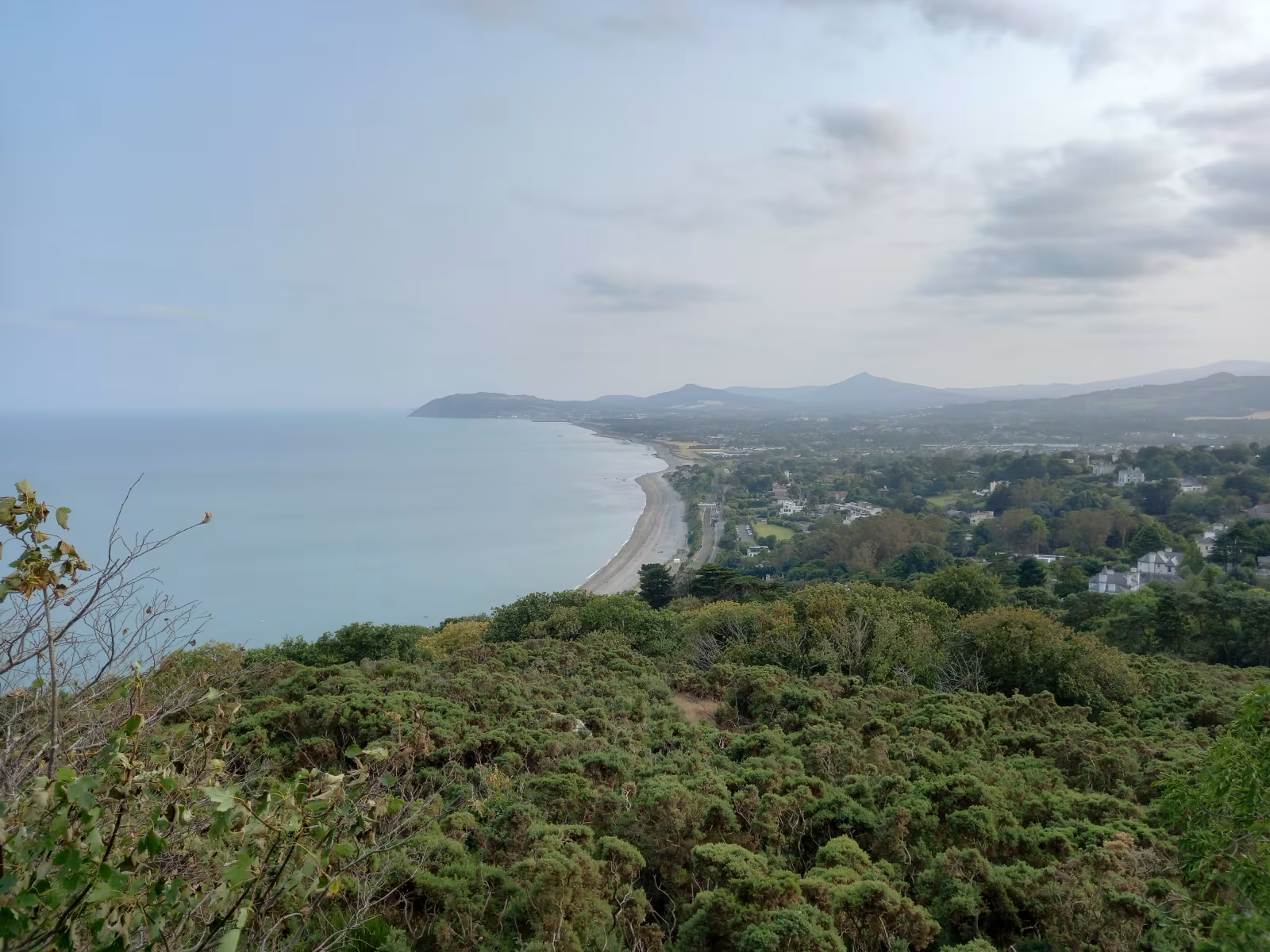
At the summit is a large granite obelisk, built in 1742 as a famine relief project to give the local poor some work through a brutal winter. From the base of it, looking south, Killiney Bay stretches out below: long and horseshoe-shaped, the pebble beach at the bottom, Bray Head closing off the far end, and the Wicklow Mountains beyond that, filling the southern horizon in a way you don't get from anywhere in the city. On a clear day you can see Wales. Clear days are aspirational but they do happen.
This is the view that gave the whole area its nickname. Someone in the nineteenth century compared Killiney Bay to the Bay of Naples, the comparison stuck, and the locals have been repeating it ever since. It's a stretch in February. In September with good light on the water, it's genuinely the best argument you can make for the south DART coast.
Vico Road and Killiney Beach
Between Dalkey and Killiney, Vico Road runs along the coast above the bay and is the kind of road that makes you slow down regardless of how you're travelling it. Walking takes about fifteen minutes from the south end of Dalkey. Halfway along is Vico Bathing Place, a concrete platform above the rocks where people swim in open water year-round. The water is cold because it's the Irish Sea and cold is what the Irish Sea does, but the regulars treat this as a point of personal distinction rather than a problem.
Killiney Beach itself, below the hill, is a long stretch of shingle with some sand at the south end, and the DART railway viaduct runs along the cliff above it. It doesn't get the crowds that west coast beaches attract, which is either a selling point or a comment on the water temperature depending on your outlook.
Where to eat and drink
In the village, Select Stores on Castle Street is the place for a good coffee and something to eat before or after the hill. It's a small deli and cafe doing sandwiches, salads, and baked goods, and it fills up quickly on weekend mornings. Get there on the early side if you want a seat.
Finnegan's is the pub you want. It's been on the main street for generations, has a fire in the winter and a garden in the summer, and the craic on a Friday evening is reliable. For a sit-down brunch, Nosh on Coliemore Road has been doing it well for years and gets busy on Sundays, so book ahead or arrive with patience.
For the broader picture of what Dublin does with food, the 2026 Dublin food guide covers the full city. And since Dalkey is a DART stop, it combines naturally with Howth at the north end of the line: the Howth guide covers the cliff walk and the seafood if you want both ends of the bay in one day.
How do I get to Dalkey from Dublin city centre?
Take the DART southside line from Connolly, Tara Street, or Pearse Street to Dalkey station. The journey from Pearse takes around 25 minutes. DART runs every ten to fifteen minutes on weekdays and less frequently on Sundays. The fare with a Leap Card is around €2 to €3. If you are heading directly to Killiney Hill Park, stay on the DART one more stop to Killiney station and walk up from there, which takes about ten minutes on foot.
Can you visit Dalkey Island?
Yes. Seasonal ferries run from Coliemore Harbour to Dalkey Island from roughly May to September. The crossing takes five to ten minutes each way. The island is uninhabited and has the ruins of a seventh-century church, a Napoleonic-era Martello tower, and a colony of wild goats. Grey seals are usually visible on the rocks offshore. The service is small-scale and weather-dependent, so check locally before you go. Swimming across from the harbour is around 300 metres of open sea and is only for experienced open-water swimmers.
How long does it take to walk up Killiney Hill?
From the park entrance on Killiney Hill Road, the walk to the summit obelisk takes around 20 to 30 minutes at a comfortable pace. The path is well-marked and free to use. The upper section is steep with some stone steps but is not technically difficult. Good trainers are fine for most of the route, though grip helps on the upper steps after rain. The park is open year-round with no entrance fee.
What is the view from Killiney Hill like?
From the summit you look south over Killiney Bay, taking in the beach below, Bray Head at the far end of the bay, and the Wicklow Mountains beyond. On a clear day Wales is visible to the east across the Irish Sea. The view inspired the nineteenth-century comparison with the Bay of Naples, which is how the area got its nickname. It is at its best in the afternoon on a clear day, when the light comes from the west and the hills behind Bray darken into blue-green.
What should I do if the weather is bad?
Dalkey Castle and Heritage Centre runs living history tours indoors regardless of weather and is a good option in the village on a grey day. If the weather makes the hill walk unappealing, the guide to indoor things in Dublin covers the best options when it's properly lashing. The DART back to the city takes 25 minutes, so cutting the day short is never much of a drama.